
Stoneham Neighbors and Block Records
One address can open several small, distinct records paths. Massachusetts GIS tools can supply parcel orientation and, where a Stoneham layer is available, adjoining geometry. The assessor portal supplies the owner string, location, physical characteristics, sale lead, and book/page on a fiscal-year assessment snapshot. A local voter list has its own request rule, and civic groups publish organization information rather than household rosters. Historical newspapers and street listings can add a dated layer, but they cannot turn a historic entry into a current identity claim.
| Stoneham source | What it can show about a block | Access and limit |
|---|---|---|
| Municipal Mapper and MassGIS | Map position, parcel geometry, and selected municipal layers. | Public map route; Stoneham layers and tools vary. |
| Patriot Properties | Parcel location, owner string, assessment fields, sale and book/page leads. | Free fiscal-year snapshot; not a household list. |
| Middlesex South Registry | Dated recorded land interests and legal-description leads. | Use document context; not proof of present occupancy. |
| Local voter list | Defined public voter fields if the Town Clerk supplies the list. | Request route; confidential and withheld fields stay withheld. |
| Library and Historical Society | Older street listings, newspapers, annual reports, tax-record leads. | Repository access, request, or research-day conditions apply. |
The useful distinction is owner of record versus an actual household. A trust, estate, corporation, or former owner can appear on a parcel record. A neighbor search should report that difference instead of converting an assessment string into a claim about who lives there.
Stoneham Neighbor Maps Have Limits
MassGIS Municipal Mapper can search and display municipal information, and may support parcel or abutter identification where the needed local layer is enabled. The research did not verify a consistent Stoneham buffer, radius, abutter-report, or export control. Zooming to a parcel and inspecting adjacent polygons is therefore a map-reading method, not a promise that the tool will generate a complete report. For legal boundary certainty, use appropriate legal or survey evidence rather than a generalized GIS line.
The town’s official map collection adds zoning and voting-precinct orientation. Its value is context. A precinct border, ZIP boundary, open-space area, and assessor parcel all describe different systems. None identifies a household. Keeping the map type and retrieval date alongside a Stoneham map note prevents one layer from being mistaken for another.
The Town Maps page is the source for this official Stoneham map view and its links to local map materials.
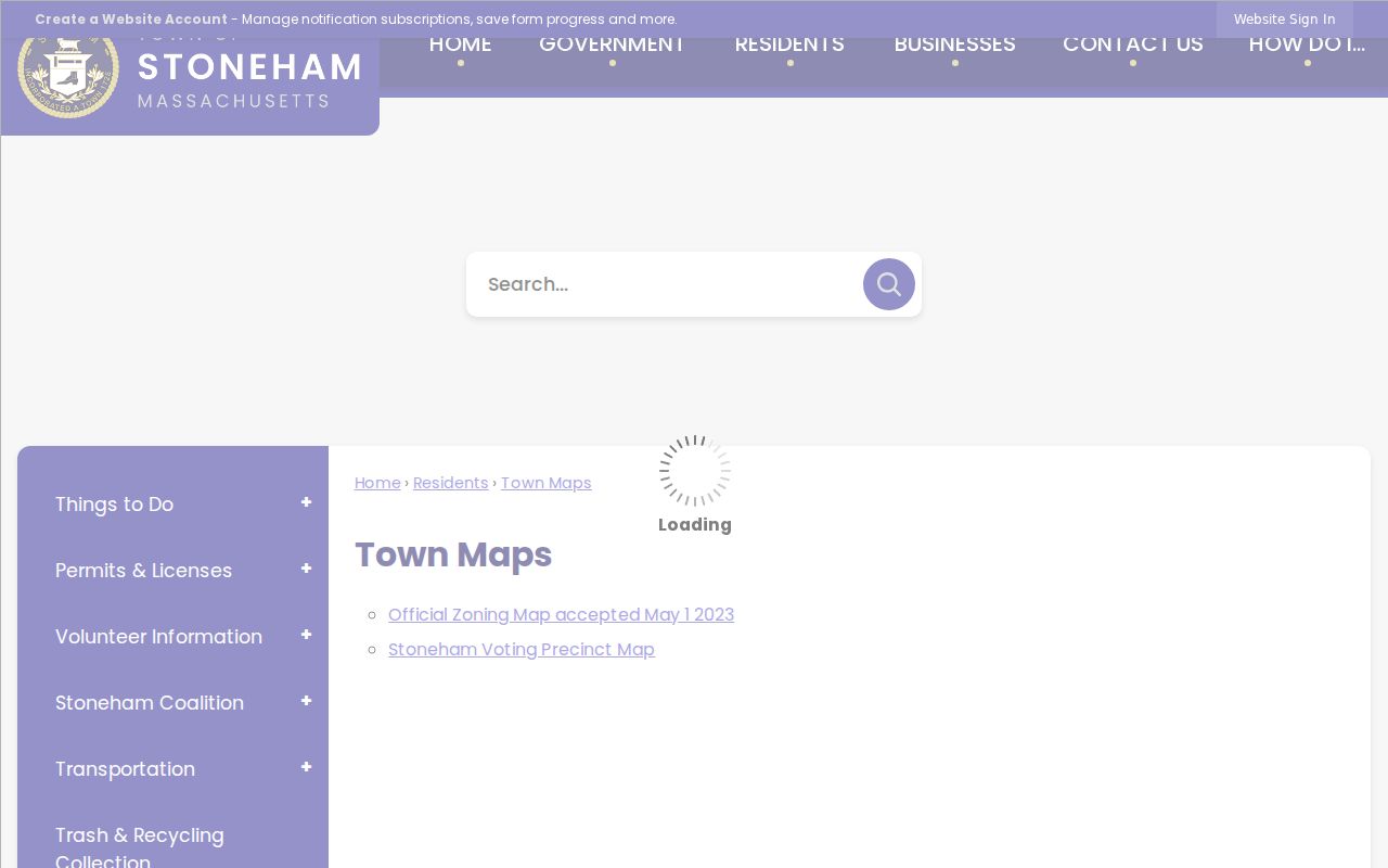
Use that source to compare map categories, then confirm a parcel question with the assessor or other record custodian that owns the underlying data.
Note: Parcel geometry is an orientation aid; use a dated official record or appropriate legal evidence when the exact boundary matters.
Mapping Stoneham Neighbors Parcel by Parcel
Work outward from a single verified address. The goal is to understand the record trail around the block, not to compile a profile of nearby people. A parcel ID and an assessment book/page provide the safest bridge between map geometry and a recorded instrument. The portal’s visible columns include Parcel ID, Location, Owner, built type, value, lot size, sale date, sale price, and book/page. Record the portal’s fiscal-year context before treating any field as current.
- Locate the address in Municipal Mapper or a town assessor map and verify that the correct parcel geometry is selected.
- Inspect adjacent parcel polygons one at a time, then note each parcel identifier rather than assuming a distance or block radius.
- Search the parcel in Stoneham Patriot Properties WebPro for the dated owner string, location, and book/page lead.
- Use the book/page or party name with the Middlesex South Registry only when a recorded land question remains. Keep document date and legal description with the result.
For the full record chain along a named street, use the Stoneham street directory. The street workflow follows a longer address chain; block research stays with the immediate parcels and map context.
Stoneham Assessor Groups Are Not Neighborhoods
The Patriot portal includes an NHood field with labels such as Bear Hi, Pine Ind, Stonegate, Stoneham Square, and The Montvale, along with quality and age classifications. These are assessor-system groups. They are not automatically official neighborhood boundaries, civic associations, or evidence of who belongs to a block. The same portal also uses land-use codes for one-family, condominium, open space, municipal, institutional, utility, and vacant parcels. A street or block can therefore include land that a casual household map misses.
Compare an NHood label with town zoning, precinct, and open-space maps only for orientation. The label may help group assessment records, while a map revision or a legal description answers a different question. This Stoneham quirk matters because administrative codes can look like familiar place names without carrying the same meaning.
- Parcel
- A mapped unit of land used by an assessor. It can identify a property record without identifying every person connected to the address.
- Situs address
- The physical location of the parcel. It can differ from a mailing address in a tax record.
- Book and page
- A recorded-document citation that helps locate a Registry instrument and its dated legal context.
Note: An assessor code is useful for sorting a record set, but it does not define a civic boundary or household.
Stoneham’s Fells Shape Block Maps
Roughly one-third of Stoneham lies within the Middlesex Fells Reservation, including Spot Pond, according to the town’s description. That geography changes what a map shows around a developed block. Open space, roads, schools, parks, cemetery land, and built parcels can all appear near one another. A map may show adjoining polygons without identifying an adjoining home. The town open-space map is useful for orientation, but it is not legal parcel evidence or a current use determination.
This is a geography check worth making before drawing a block conclusion. In Stoneham, a line that looks close on screen may cross a reservation edge, an institutional parcel, or a map layer with a different purpose. Pair the map with the parcel record, document date, and official map title instead of relying on visual proximity alone.
Stoneham Civic Groups Are Not Neighbor Lists
Stoneham’s community layer includes the Stoneham Chamber, Explore Stoneham, Stoneham CAN, the Public Library, Historical Society, churches, veteran groups, and other civic organizations. The Chamber reports more than 250 members. These links can help a researcher understand a district’s civic activity or find an organization’s own contact route. They do not establish a complete directory for a street or block.
| Community source | Appropriate Stoneham use | What it does not establish |
|---|---|---|
| Chamber and Explore Stoneham | Business and civic community context. | A household or parcel roster. |
| Stoneham CAN | Community-development organization information. | Membership at an address. |
| Library and Historical Society | Historic sources and repository help. | Present-day household composition. |
| Town Day and HRC resources | Public civic and service links. | An official neighborhood-association inventory. |
No official comprehensive neighborhood-association or HOA directory, and no verified member directory, was located. Ask Planning, the Town Clerk, the Chamber, or a recognized umbrella group for a current organization inventory before claiming coverage.
Note: Organization links describe public groups, not attendance, membership, or residence at a particular Stoneham address.
Stoneham Voter Data Has Block Limits
The Massachusetts individual voter search requires first and last name, date of birth, residential ZIP, and an acknowledgement. It returns a bounded result about registration or pre-registration, active or inactive status, polling place, officials, and the biographical information supplied by the user. It is not a street-browse tool. A local voter list may be requested from the Town Clerk under current rules, with production cost and defined public fields, but phone, email, confidential voters, minors, and other protected fields are withheld.
The statewide voter list is not a general public download. A lawful block-level civic question begins with the current Secretary of the Commonwealth access guidance and a narrowly scoped Town Clerk request. A missing person or address should never be treated as an error because confidential status, recent registration, spelling, and other limits can affect results.
Official Records and Stoneham Neighbor Tools
Official records identify their custodian, source date, field limits, and correction path. Commercial neighbor-lookup products can combine stale public fragments, marketing data, user-submitted material, and automated inferences. A match may merge same-name people or carry an old address forward. That makes the official route slower in some cases, but far clearer about what a field means and who can correct it.
| Official source route | Commercial category |
|---|---|
| Shows a defined record, source date, and custodian. | May combine records from differing dates and provenance. |
| Provides a clerk, agency, or repository for correction. | Correction and claim practices can vary by provider. |
| Preserves access limits and protected fields. | May imply a fuller profile than the underlying records support. |
When an official source does not answer the question, use the responsible office, a written public-records request, the library, or the Historical Society. Do not fill the gap with an unverified personal-data result.
Note: Preserve the custodian, document date, and access limit with each block finding so its scope remains clear.
Privacy Limits on Stoneham Neighbors
Massachusetts public-records access does not erase source-specific privacy rules. The Address Confidentiality Program provides a substitute address for eligible participants. Confidential voter records, court impoundment, RMV restrictions, health-license privacy, and M.G.L. c.66 §10B can protect fields from disclosure. Public parcel, deed, historic newspaper, or map material should never be joined to reverse a protected address or identify a household from an incomplete record.
A map, assessment record, or old directory is not permission to publish every field it contains. Keep the smallest amount of information needed for the question, state the source and date, and ask the custodian to correct an official error.